Updated:
04-Dec-2025 1:10am @
|
 |
The station is located Lat: 33° 39´ 11´´ N | |||||||||
| Time of Next Full Update: 1:15 am - Station Elev: 0 ft | ||
Weather Links: |
|
 New Feature New Feature |
Celebrating
|
Current Conditions
| @ 04-Dec-2025 1:10am | |
|
45.0°F
|
|
| Temp Change: | °F /hr |
| Feels Like: | 45 °F |
| Humidity: | 64% |
| Dew Point: | 33.5 °F |
| Wind: | Calm --- mph |
| Gust: | 0.0 mph |
| Pressure: | 30.22 in Steady |
| Solar Rad: | 0% 0 W/m2 |
| UV Index: | 0.0 None |
| Rain Today: | 0.00 in |
| Rain Rate: | 0.000 in |
| Rain Month: | 0.00 in |
| Rain Year: | 14.41 in |
Almanac
| Sunrise: | 7:17 am | |||
| Sunset: | 5:19 pm | |||
| Moonrise: | 4:09 pm | |||
| Moonset: | 7:06 am | |||
|
||||
Daily Min/Max
| Today's High Temp: | 46.7°F 12:06am |
| Today's Low Temp: | 45.0°F 1:08am |
| Today's High Humidity: | 65% 12:00am |
| Today's Low Humidity: | 63% 12:35am |
| Today's High Dewpoint: | 35.6°F 12:06am |
| Today's Low Dewpoint: | 33.5°F 1:08am |
| Today's High Barometric Pressure: | 30.226 in/Hg 12:42am |
| Today's Low Barometric Pressure: | 30.213 in/Hg 12:00am |
| Today's High Wind Speed: | 0.0 mph 4:54pm |
| Today's High UV: |
0.0 None 12:00am |
| Today's High Solar: |
0 W/m2 12:00am |
| Today's High Rain Rate: | 0.000 in/min 5:00pm |
| Today's High Hourly Rain Rate: |
0.000 in/hr |
| Days Since Last Rain: |
9 Days |
Current NWS Alerts:
|
| |
|
|
|
|
|
|

|
|
For more information |
|
 |
|
Return to Top |
|
Welcome to Pepperridge North Valley's |
||||
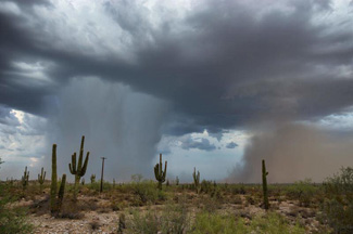
Enjoy These Photos from Arizona - Click on picture for full Size View!

The date is currently Dec 4, 2025. The time is 0813 Zulu, 08:13:27 UTC.
The above animated images are produced by NOAA GOES Satellite Distribution Center
Script by SELincoln Weather - Resizing Code by Southern Maryland Weather Used the Tabs above the Animated Satellite Images to Select the Satellite Band and Satellite View
| Additional Satellite maps can be found at the following links:N.O.A.A. Goes 16 Satellite ImageryN.O.A.A. Goes 17 Satellite ImageryN.O.A.A. Goes 19 Satellite ImageryN.O.A.A. Satellite ImageryUniv of Arizona Satellite ImageryWet Microbust Over the Rainbow Valley on Aug 2nd, 2018
Please Visit Our Sister Site for;
|


