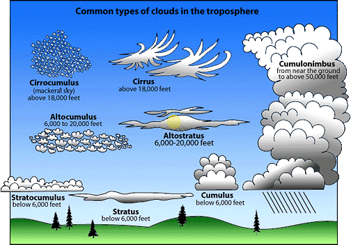
Cloud Type Indentification Chart |
|
High Cloud Types |
| Cirrus |
Cirrostratus |
Cirrocumulus |
|
|
|
Cirrus is a high level cloud composed of ice crystals and appears in many forms, often these clouds appear with streams of virga, which is rain or snowflakes that evaporate
as its falls into the lower warmer air. |
Cirrostratus is a filmy layer of milky-white ice crystal cloud normally covering the entire sky. The cloud can sometimes be 5,000 - 10,000 feet in thickness. |
Cirrocumulus is still higher water droplet cloud with smaller cloud elements resembling scales on the back of a fish, thus the term mackeral sky. |
Base elevation:25,000-30,000 feet
Top elevation: 35,000-50,000 feet |
Base elevation:20,000-25,000 feet
Top elevation: 30,000-40,000 feet
|
Base elevation: 15,000-18,000 feet
Top elevation: 20,000-30,000 feet
|
Mid Level Cloud Types |
| Altocumulus |
Altostratus |
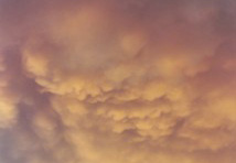
Cumulus Mammantus |
|
| |
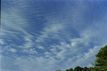
Altocumulus is a high layer of lumpy cloud elements. Lumps show the presence of rising air; thin regions show descending air. Sometimes it is described as a buttermilk sky.
|
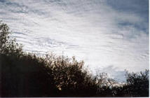
Altostratus is a layer of gray water droplet cloud of uniform thickness. The sun can be seen as a difuse image. As time passes, this cloud often lowers and thickens to become nimbostatus with rain.
|
Cumulus mammatus is a low to mid level cloud often associated with mature thunderstorms. These clouds ofter appear in the vicinity of these thunderstorms. They tend appear beneath the tops of a cumulonimbus cloud. This is an indication of very active updrafts and downdrafts and can be a sign of severe weather.
|
Base elevation:12,000 - 15,000 feet
Top elevation: 15,000 - 20,000 feet |
Base elevation:12,000 - 15,000 feet
Top elevation: 15,000 - 20,000 feet
|
Base elevation: 10,000 - 15,000 feet
Top elevation: 20000 - 25,000 feet
|
Low Cloud Types |
| Stratus |
Stratocumulus |
Cumulus |
|
|
|
Stratus is a low gray cloud mass usaully associated with winter storms this clouds presence may lead to widespread and continuous rain or snow falls.
|
Stratocumulus is a low layer of grayish cloud showing lumpy thick/thin regions. It is a very common cloud type. At one time the cumulus activity may prevail; at another, the stratus form may prevail.
|
Cumulus are flattish-based heaps or mounds of cloud with rounded tops well separated from each other. They may develop vertially with time
|
Base elevation: 1,000 - 2,000 feet
Top elevation: 10,000 - 15,000 feet
|
Base elevation: 6,000 - 8,000 feet
Top elevation: 10,000 - 15,000 feet |
Base elevation: 2,000 - 3,000 feet
Top elevation: 4,000 - 6,000 feet
|
Low Cloud Types with Vertical Development |
| Cumulus Conjestus |
Towering Cumulus |
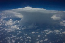
Cumulonimbus with Anvil |
|
|
|
Cumulus Congestus are puffy clouds which are just starting vertical development. Congestus denotes a cloud with active vertical development. These clouds can lead to the development of thunderstorms and cumulonimbus clouds.
|
Towering Cumulus is the second stage in the development of a Cumulonimbus cloud. Depending on atmosphere conditions this cloud may mature in a Cumulonimbus cloud or thunderstorm.
These cloud have a billowy characteristic with clean sharp edges and a cauiflower shape. As the
The top continues to rise, (grow in height), it is most likely composed of ice crystals.
|
Cumulonimbus with Anvil - This cloud is most advanced form of the cumulus family. It is a mature storm where the top of the cloud has fanned out and is most likely composed of ice crystals and it is a indicatered of possible severe weather , with Heavy rain , hail, lightning and thunder, and tornados are possible in this savage cloud.
|
Base elevation: 1,000 - 2000 feet
Top elevation: 10,000 - 15,000 feet
|
Base elevation: 3,000 - 5,000 feet
Top elevation: 20,000 - 50,000 feet |
Base elevation: 2,000-3,000 feet
Top elevation: 40,000 - 60,000 + feet |
Low Cloud Types with Precipitation |
| Nimbostratus |
Cumulonimbus |
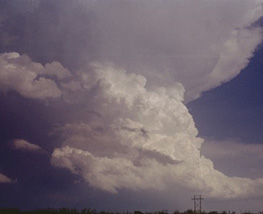
Super Cell Cumulonimbus |
|
|
|
Nimbostratus is a gray cloud mass from which widespread and continuous rain or snow falls. This cloud is usually associated with low pressure frontal systems and winter weather storms it is also associated with a warm front storm system.
|
Cumulonimbus is the one of the most advanced stages of the cumulus family. The top is likely composed of ice crystals. It is no longer sharp edged, but fuzzy. The top sometimes takes the shape of an anvil. Heavy rain showers, hail, lightning and thunder, are possible in this savage cloud.
|
Supercell Cumulonimbus with Anvil - This cloud is example of a large Thunderstorm Complex. It is a mature storm where severe weather is likely. Heavy rain , hail, lightning and thunder, and tornados are possible in this thunderstorm Complex.
|
Base elevation: 1,000 - 2000 feet
Top elevation: 10,000 - 15,000 feet
|
Base elevation: 3,000 - 5,000 feet
Top elevation: 30,000 - 50,000 feet
|
Base elevation: 2,000-3,000 feet
Top elevation: 40,000 - 60,000 + feet |
All cloud type photos are copyrighted © 2005 - 2010 by Pepper Ridge North Valley Weather - All rights reserved. Unauthorized duplication or distribution is prohibited. Please also check out the Weather Glossary with over 950 weather related terms and definitions.

 New Feature


