Welcome to the Pepper Ridge North Valley's
Severe Weather Page
This is your weather warning resource page. Check this page for the latest watches and warning updates,
from The National Weather Service, Phoenix, Az.!
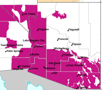
MAP OF CURRENT SOUTHWEST WATCHES, WARNINGS AND ADVISORIES
Local & Regional Weather Statements, Watches And Warnings
Weather Alerts for Northwest Deserts/KingmanIssued by the National Weather Service |
| No severe weather expected for Northwest Deserts/Kingman |
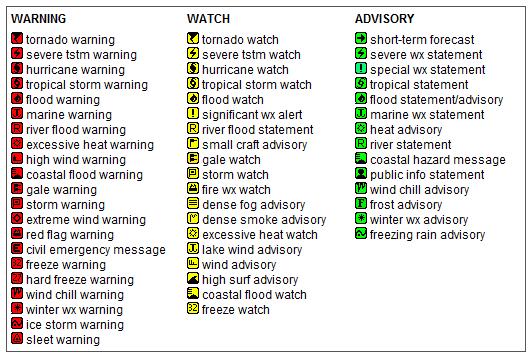
Key to Icons for Local & Regional Weather Statements, Watches And Warnings
Map of the Current Watches, Warnings, and Advisories Nationwide:

|
|
Member of the:


|
North Valley Random Weather Facts |
MONSOON
The best example of a monsoon on Earth occurs over the Indian sub continent. During the months of April through October, a moist southwest wind brings heavy rains to this region...while a dry northeast wind is prevalent during the remainder of the year.
In North America, a similar situation occurs over much of Mexico. For example, in Acapulco, rainfall averages 51.8 inches during the months of June through October...while only 3.3 inches falls during the remainder of the year.
In the United States, Arizona and New Mexico are located on the northern fringe of the Mexican Monsoon. For most of the year, winds aloft over the southwest U.S. are west to northwest. During the summer, winds turn to a more south to southeast direction, importing moisture from the Pacific Ocean, the Gulf of California and the Gulf of Mexico.
Get the Facts PHP
|
|
Page layout last updated on Mar 8th, 2024
|
|
|

 New Feature