Updated:
17-Jun-2026 2:55am @
|
 |
The station is located Lat: 33° 39´ 11´´ N | |||||||||
| Time of Next Full Update: 3:00 am - Station Elev: 1469 ft | ||
Weather Links: |
|
 New Feature New Feature |
Celebrating
|

Current Conditions
| @ 17-Jun-2026 2:55am | |
|
90.6°F
|
|
| Temp Change: | °F /hr |
| Feels Like: | 91 °F |
| Humidity: | 37% |
| Dew Point: | 60.8 °F |
| Wind: | Calm --- mph |
| Gust: | 0.0 mph |
| Pressure: | 29.62 in Steady |
| Solar Rad: | 0% 0 W/m2 |
| UV Index: | 0.0 None |
| Rain Today: | 0.00 in |
| Rain Rate: | 0.000 in |
| Rain Month: | 0.00 in |
| Rain Year: | 0.72 in |
Almanac
| Sunrise: | 5:17 am | |||
| Sunset: | 7:40 pm | |||
| Moonrise: | 7:59 am | |||
| Moonset: | 9:43 pm | |||
|
||||
Daily Min/Max
| Today's High Temp: | 92.6°F 1:42am |
| Today's Low Temp: | 87.0°F 1:18am |
| Today's High Humidity: | 37% 2:38am |
| Today's Low Humidity: | 29% 12:00am |
| Today's High Dewpoint: | 61.2°F 2:38am |
| Today's Low Dewpoint: | 54.4°F 12:33am |
| Today's High Barometric Pressure: | 29.639 in/Hg 12:33am |
| Today's Low Barometric Pressure: | 29.618 in/Hg 2:08am |
| Today's High Wind Speed: | 0.0 mph 2:46pm |
| Today's High UV: |
0.0 None 12:00am |
| Today's High Solar: |
0 W/m2 12:00am |
| Today's High Rain Rate: | 0.000 in/min 2:00pm |
| Today's High Hourly Rain Rate: |
0.000 in/hr |
| Days Since Last Rain: |
98 Days |
|
| |
|
|
|
|
|
|

|
|
For more information |
|
 |
|
Return to Top |
|
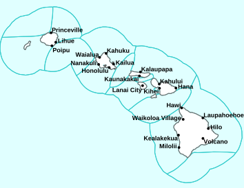
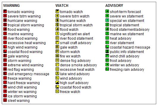
Welcome to Pepperridge North Valley'sHawaiian Current, Watches, Warnings and Advisories Page |
||||||||||||
|
ALOHA! Welcome to Paradise!
Enjoy These Photos from Hawaii - Click on picture for full Size View!
Current Reported Weather Advisiories for Oahu's Eastern Windward Shores
Page layout last updated on March 25th, 2024 | ||||||||||||


Copyright © 2005 - 2026, Pepper Ridge North Valley Weather - All rights reserved .
Unauthorized duplication or distribution is prohibited
Powered By: |
Weather Display vers: 10.37S build: 134 &
WeatherLink 5.71 |
Site Template Designed by: Pali Plumies Designs
Disclaimer:
Never base important decisions on this or any weather information obtained from the Internet.
Number of Visitors Since March 15, 2005